
Watershed Study
Clarks Fork/Upper Shoshone River Level I Watershed Study
A Comprehensive Watershed Planning Document to Identify Key Land Use and Water Resources Issues and Conservation Practices to Address those Concerns
Partners: Wyoming Water Development Office (WWDO), Cody Conservation District, Powell Clarks Fork Conservation District, and Trihydro Corporation (Lander, WY Office)
The purpose of the study is to generate a comprehensive planning document that the conservation districts can utilize to implement water resource management strategies and conservation practices to address water and land resources concerns within the Study Area. Check our News Tab for updates about the Study
The Cody Conservation District and the Powell Clarks Fork Conservation District have partnered to initiate the Clarks Fork Upper Shoshone River Watershed Study. Trihydro Corporation, based in Laramie, Wyoming, has been selected to complete the project, which is fully funded by the Wyoming Water Development Commission and planned for completion by March 2024.
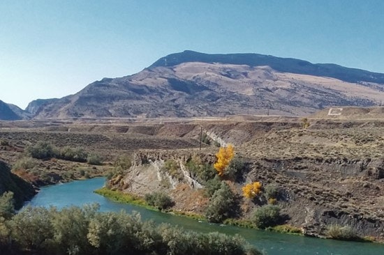
The project study area consists of the Shoshone River from its headwaters in Yellowstone National Park, extending downstream beyond Powell. In addition, the portion of the Clarks Fork drainage that lies within Wyoming is included.
The purpose of the study is to generate a comprehensive planning document that the conservation districts can utilize to implement water resource management strategies and conservation practices to address water and land resources concerns within the Study Area.
The project's specific objectives and activities include:
- Completing a comprehensive evaluation and description of the study area, which will include quantifying surface water resources, riparian/upland conditions, and stream channel conditions.
- Meeting with interested stakeholders to discuss their water-related issues and conduct on-site visits to discuss potential solutions. Conceptual project designs and cost estimates will be prepared for those participants and applications for funding assistance will be provided. Site evaluations can consider a wide range of new construction or rehabilitation projects, including irrigation infrastructure (diversions, headgates, etc.), upland water sources (stock reservoirs, pipelines/stock tanks, etc.), wells, solar platforms, and stream channel restoration efforts. There is no cost for stakeholders to participate.
- Developing a Watershed Management Plan that identifies problem areas within the watershed and proposes practical economic solutions. The Watershed Management Plan will include information about permitting requirements and funding opportunities. The Watershed Management Plan will represent an additional opportunity for the State of Wyoming to provide benefit to the local community and the State of Wyoming through the completion of another in their series of watershed studies being completed throughout the state.
- As a direct result of the Level I watershed investigation process and the completion of the watershed management plans to date, numerous conservation districts and stakeholders have reaped the benefits of this program.
The Cody Conservation District is looking for interested landowners and stakeholders that have water related issues and are looking for potential solutions. If you are interested in learning more about the Study or would like to schedule a site visit, please contact the Cody Conservation District!
